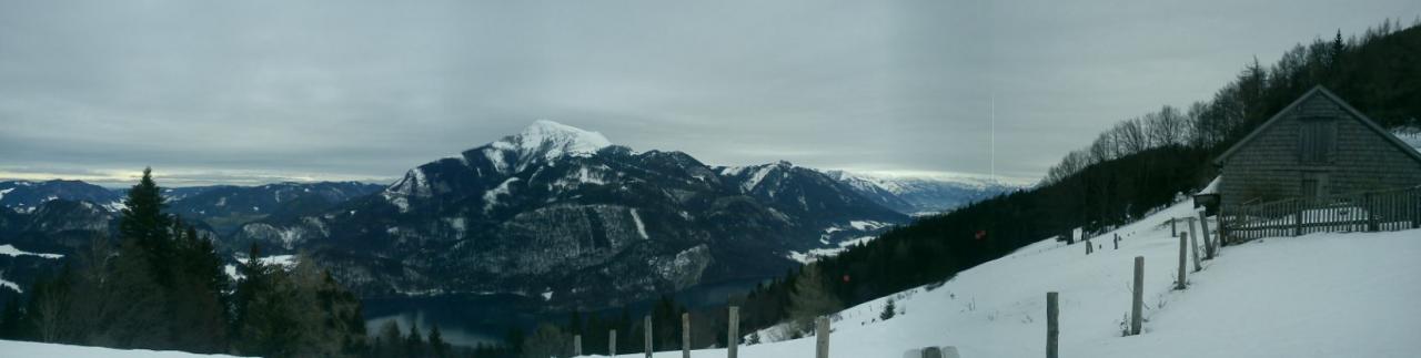
Zwoelferhorn
Route Character
Easy training tour with various ascent and descent options
Starting Point & Village
Starting point: Parking lot of the Zwölferhorn cable car St. Gilgen at 567m or parking place at the “Laimerlift” at 611m. Village: St.Gilgen
Ascent & Route
Start from the car parks Zwölferhornseilbahn or Laimerlift - ascent via the ski slope - the trail is well signposted. There are some shortcuts (hiking trails and hollow paths) through which you can escape the piste partially. After about an hour you will reach the Sausteigalm, where you can stop for a refreshment and enjoy a fantastic view over the Wolfgangsee. Afterwards we go on - here are two options:
- via the Elferstein, a side peak of the Zwölferhorn. The path goes through the forest and is relatively steep - hairpin bends should not be a foreign word.
- continue along the piste. After about two hours you reach the top of the Zwölferhorn, where you have a fantastic view over the lake region of the Salzkammergut and the Dachstein. Next to the cable car mountain station there is another stop for refreshments.
Descent & Variants
About the Elferstein or the front-slope of the Zwölferhorn, which is (fortunately) only rarely groomed. If you are going for fresh snow, you should start early in the morning, as the Zwölferhorn is a popular training mountain and therefore well visited in the early morning hours. Another downhill variant is the Stubneralm - on the left hand side of the Franzlshütte the winter hiking trail leads past it - follow it until you see a wide chute on the right hand side - into this one you ride down and reach a forest path, which you follow out of the valley. At the end of the forest trail, you will return to the Sausteigalm with a 5-minute ascent (signposted), from where you can descend via the slopes. For this option you should absolutely check the avalanche situation.
Maps
ÖK 50 Blätter 65 (Mondsee) and 95 (St. Wolfgang im Salzkammergut)
In the map I have only marked the descent over the Stubneralm, because the ascent and the first downhill variants are very clearly noticeable.
Photo Gallery
A selection of 1 photos from the tour:
Map and Avalanche Risk
[ASTRO_MAP_INFO_EN]
Image Gallery (1 Photos)
Slope Map
Tour Planning & Important Notes (OpenSlopeMap)
Tour Planning
You can plan and create your own tour directly in the map. The tour can then be downloaded as a GPX track.
Disclaimer
Every user of the map agrees to use the maps provided on OpenSlopeMap.org at their own responsibility and risk. OpenSlopeMap.org and its operators accept no responsibility for damages.
Map Explanation
- Slope inclinations are a very important criterion in avalanche risk management. However, slope inclination alone should never be the sole criterion!
- The resolution for Austria and South Tyrol is based on a digital terrain model (DTM) with 10m resolution. Outside these areas, accuracy is significantly lower.
- A map can only ever provide a limited view of real conditions.
Frequently Asked Questions
How difficult is this splitboard route?
The route is classified with difficulty level 2.
How many vertical meters does the tour include?
The ascent covers approximately 970 vertical meters.
How long does the ascent take?
The tour takes around 2 hours.
Where does the route start?
The starting point of the tour is St.Gilgen.