Serles
Route Character
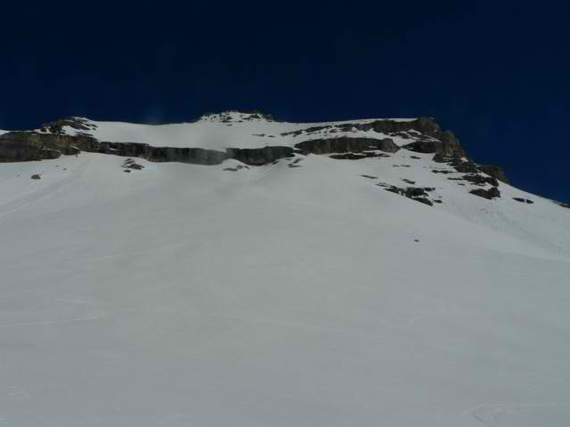
Good steep splitboard / ski tour to one of the most prominent peaks of Innsbruck, early getting up is necessary due to the exposure (we stopped 50m before the summit to reach the valley safely). The descent is somewhat tricky through the rock band. Make sure to remember where the passage is during the ascent, otherwise you will be standing on the rock band,…
Starting Point & Village
Starting point: Ochsenalm 1558m Village: Matrei am Brenner
Ascent & Route
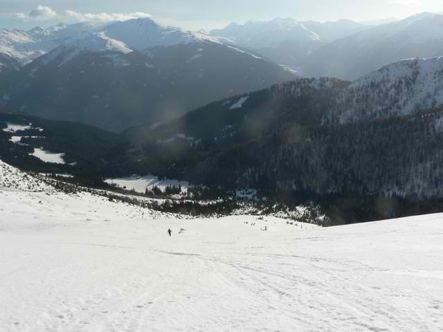
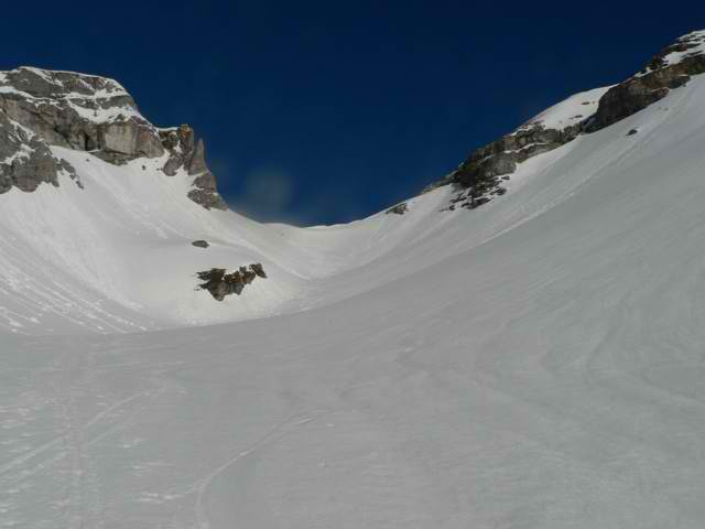
From the car park we carry the Splitboards / skis in good old ski touring manner (splitboards are in hike mode) over a small peak up to the Ochsenalm (1558m) which we pass on the right. In the valley floor we go in discreet gradient up to a height of approx. 1750m. Here we turn right (north-west) and climb up to a hollow below the Serlesjöchl. Here we start to look for the passage in the rock belt. As soon as we have found it, we memorize exactly how to get there from above. In case of uncertainty it is better to make the descent along the ascent track. Now it’s a bit steeper and we reach the Serlesjöchl (2384m).
Now comes the key point (in summer you sometimes have to queue up in good weather, or climb the steep slope to the right of it) an secured gully (max. 5hm), which, due to its sunny position, is free of snow early and usually offers no difficulties. The splitboards / ski touring skis are shouldered here for a short time, then we can climb steeply over the south-west ridge and reach the summit of the Serles 2717m at 11.00 a. m. at the latest (obviously depends on the warming of the day).
Descent & Variants
Along the ascent track or directly south.
Be careful with the rock band, the passage is not easy to find from above and the south flank is so steep (approx. 40 °) that one does not want to unbuckle above the rock face to reach the passage.
Maps
Kompass Karte WK36: Innsbruck, Brenner: Wandern / Rad / Skitouren. 1:50.000
Alpenvereinskarte 31/5 Innsbruck und Umgebung 1 : 50 000 Topographische Karte
Photo Gallery
A selection of 4 photos from the tour:
Map and Avalanche Risk
[ASTRO_MAP_INFO_EN]
Image Gallery (4 Photos)
Show all 1 more photos
Slope Map
Tour Planning & Important Notes (OpenSlopeMap)
Tour Planning
You can plan and create your own tour directly in the map. The tour can then be downloaded as a GPX track.
Disclaimer
Every user of the map agrees to use the maps provided on OpenSlopeMap.org at their own responsibility and risk. OpenSlopeMap.org and its operators accept no responsibility for damages.
Map Explanation
- Slope inclinations are a very important criterion in avalanche risk management. However, slope inclination alone should never be the sole criterion!
- The resolution for Austria and South Tyrol is based on a digital terrain model (DTM) with 10m resolution. Outside these areas, accuracy is significantly lower.
- A map can only ever provide a limited view of real conditions.
Frequently Asked Questions
How difficult is this splitboard route?
The route is classified with difficulty level 5.
How many vertical meters does the tour include?
The ascent covers approximately 1159 vertical meters.
How long does the ascent take?
The tour takes around 3.5 hours.
Where does the route start?
The starting point of the tour is Matrei am Brenner.