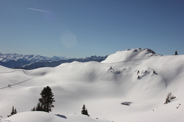
Rofanspitze
Route Character
Great Rofan transition, after fresh snowfall frequently avalanche endangered, best with firn. The high plateau is also great for spending a relaxed day with the family up the mountains there.
Starting Point & Village
Starting point: Erfurter Hütte 1831m (top station Rofanbahn) or if you like to avoid the cable car start hiking at the valley station. Village: Maurach
Ascent & Route
From the top station to the North-east passing the Mauritzalp towards Grubastieg. We follow the trail (Grubastieg) which heads in a wide right turn to the southeast and then slightly to the left towards Grubalacke (small lake). While passing the Rossköpfe in nearly flat terrain, stay in safe distance to their steep faces (wet snow avalanches might go off).
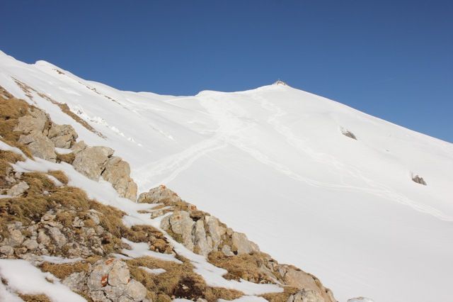
At about 2100m we reach the col of Grubascharte from where you can see the summit slope. Now you traverse towards the summit slope and climb it with a few kick-turns to the top of Rofanspitze, 2259m.
Descent & Variants
Like ascent, or the direct, very demanding way down to the South (1600 vertical meters to Wiesing).
The downhill to Wiesing requires absolute safe avalanche conditions and has quite steep sections (35°).
We head down to the South, between Sagzahn and Grubasee we keep slightly to the right and reach the Scherbensteineralp (1850m). Now comes a short flat section and just before the Issköpfl we turn to the right (South) and enter the steep slope down to Alpigalp (1480m). We pass the alp and ride through sparse forest till we reach a forest road.
Now the big fun is over and we follow the forest road to Wiesing.
Here we take the bus back to Maurach (every full hour) at the bus stop which you will recognize easily or we take a taxi.
Keep in mind that this downhill option is frequently avalanche endangered and with safe conditions in spring the lower part can already be free of snow.
Maps
Alpenvereinskarte 06 Rofan 1 : 25 000: Topographische Karte
Kompass Karte: Achensee 1 : 35 000: Wandern, Rad, Skitouren, Langlauf
Photo Gallery
A selection of 2 photos from the tour:
Map and Avalanche Risk
[ASTRO_MAP_INFO_EN]
Image Gallery (2 Photos)
Slope Map
Tour Planning & Important Notes (OpenSlopeMap)
Tour Planning
You can plan and create your own tour directly in the map. The tour can then be downloaded as a GPX track.
Disclaimer
Every user of the map agrees to use the maps provided on OpenSlopeMap.org at their own responsibility and risk. OpenSlopeMap.org and its operators accept no responsibility for damages.
Map Explanation
- Slope inclinations are a very important criterion in avalanche risk management. However, slope inclination alone should never be the sole criterion!
- The resolution for Austria and South Tyrol is based on a digital terrain model (DTM) with 10m resolution. Outside these areas, accuracy is significantly lower.
- A map can only ever provide a limited view of real conditions.
Frequently Asked Questions
How difficult is this splitboard route?
The route is classified with difficulty level 2.
How many vertical meters does the tour include?
The ascent covers approximately 428 vertical meters.
How long does the ascent take?
The tour takes around 1.5 hours.
Where does the route start?
The starting point of the tour is Maurach.