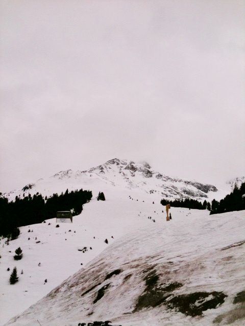
Oberstkogel
Route Character
Beautiful but somewhat extreme splitboard / ski tour in the touring region Sellrain. Gorgeous chute up to 45 degrees on the north side. The conditions must be absolutely safe for this splitboard / ski tour, also the ascent is not easy, because you have to climb in order to get into the chute at the summit of Oberstkogel (II. to III. degree).
Starting Point & Village
Starting point: Parking at the Praxmar inn, the same starting point as Zischgeles and Lampsenspitze. Here you will also meet a lot of ski tourers and some less common splitboarders. Village: St. Sigmund im Sellrain
Ascent & Route
After we have set up our splitboards, switched on the LVS device and checked our gear, we head south on the track prepared by the snowcat This is the same route at the beginning as to Zischgeles. Through the beautiful splitboard terrain we follow the ascent to the west-south-west, which is mostly already tracked by ski touring friends.
On the left side (direction south) we already see our descent, the beautiful S-shaped channel from Oberstkogel. We take out the binoculars to assess the snow conditions from a distance as good as possible. Then we continue in the direction of Zischgeles.
At about 2500 m we turn south and go into mostly untouched steep terrain. In many kickturns we continue heading south, until we reach a plateau, then we head east to the summit. (Variant: We continue in the direction of Zischgeles, when we have reached the ridge (approx. 2800m) we walk on to the east, until we reach the summit after a short climb.
Descent & Variants
Like ascent or through the S-shaped channel. Careful, only with very strong driving skills, good orientation and absolutely safe conditions.
Refreshments & Huts
Alpengasthof Praxmar mit schöner Sonnenterasse, die einen Blick auf die umliegende Bergwelt ermöglicht.
Photo Gallery
A selection of 1 photos from the tour:
Map and Avalanche Risk
[ASTRO_MAP_INFO_EN]
Image Gallery (1 Photos)
Slope Map
Tour Planning & Important Notes (OpenSlopeMap)
Tour Planning
You can plan and create your own tour directly in the map. The tour can then be downloaded as a GPX track.
Disclaimer
Every user of the map agrees to use the maps provided on OpenSlopeMap.org at their own responsibility and risk. OpenSlopeMap.org and its operators accept no responsibility for damages.
Map Explanation
- Slope inclinations are a very important criterion in avalanche risk management. However, slope inclination alone should never be the sole criterion!
- The resolution for Austria and South Tyrol is based on a digital terrain model (DTM) with 10m resolution. Outside these areas, accuracy is significantly lower.
- A map can only ever provide a limited view of real conditions.
Frequently Asked Questions
How difficult is this splitboard route?
The route is classified with difficulty level 5.
How many vertical meters does the tour include?
The ascent covers approximately 1025 vertical meters.
How long does the ascent take?
The tour takes around 3.5 hours.
Where does the route start?
The starting point of the tour is St. Sigmund im Sellrain.